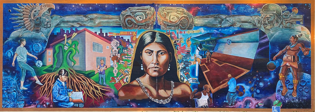
Representative of “the ultimate strength, the woman fighter, the mother who protects her children from harm,” the legacy of civil rights leader Toypurina (Tongva, 1760-1799) lives on the main wall of Ramona Gardens in East Los Angeles as a 60-by-20 foot mural along Anza National Historic Trail. Photo by NTorres/National Park Service
AIANTA Partnership with the Juan Bautista de Anza National Historic Trail
In a one-of-a-kind partnership with the National Park Service, AIANTA is chronicling the tribal destinations located on or near the Juan Bautista de Anza National Historic Trail.
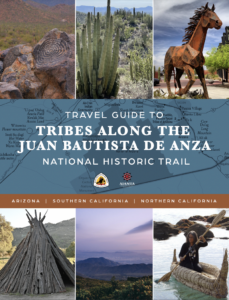
The historic collaborative partnership five years in the making will result in educational webinars for tribes, a print/online guidebook reflecting past and present-day tribal attractions at key spots along the trail, and a map of Indigenous place names along and near the Anza trail. The place names were generously shared for the purposes of this project by the Tribes who are their caretakers.
Join Us
Preliminary Outreach Calls
Outreach to the 70+ Arizona and California tribes located within 100 miles of the trail has already begun. Tribes that fall within the 100-mile radius are encouraged to sign up for outreach conference calls with AIANTA, which allow AIANTA to explain the project in more detail and also give tribes the opportunity to share their cultural offerings with the AIANTA team.
In-Person Visits
Additionally, AIANTA travel writers will be reaching out to tribes individually to schedule in-person visits. During his visits, he will meet with tribal historians, cultural center and tourism representatives, and other stakeholders interested in promoting their cultural tourism offerings.
If you’d like more information about these opportunities, please contact Gail Chehak (gchehak@aianta.org) at AIANTA to explore ways you can participate.
More Resources
Juan Bautista de Anza National Historic Trail
“¡Vayan Subiendo!”(“Everyone mount up!”) was the rousing call from Juan Bautista de Anza. In 1775-76, he led some 240 men, women, and children on an epic journey to establish the first non-Native settlement at San Francisco Bay. Today, the 1,200-mile Juan Bautista de Anza National Historic Trail connects history, culture, and outdoor recreation from Nogales, Arizona, to the San Francisco Bay Area. National Park Service
The Anza Trail Today and Commemorating 250 Years
The years 2025 and 2026 will mark the 250th anniversary of the historic Anza Expedition. Since the establishment of the Juan Bautista de Anza National Historic Trail in 1990, public history has changed dramatically. We have broadened our understanding of the people and forces at play during the expedition and included multiple narratives in the story. Join Naomi Torres, Superintendent of the Juan Bautista de Anza National Historic Trail for an update on trail activities to date and a shared view into the future. View the webinar at www.sbthp.org/lectures.
Anza Trail Interactive Map
Use the interactive map on the National Park Service site to customize your own trip along the Ana Trail.
www.anzahistorictrail.org/
Anza National Historic Trail on Facebook
Join the nearly 4,000 fans following the history and happenings of the Anza National Historic Tail on Facebook.
www.facebook.com/AnzaTrailNPS

